Precision Cemetery Mapping
Accurate maps your staff will use in the field.
Field-verified, to-scale maps and detailed interment records, authored for the people who manage the grounds daily.
Request a Pilot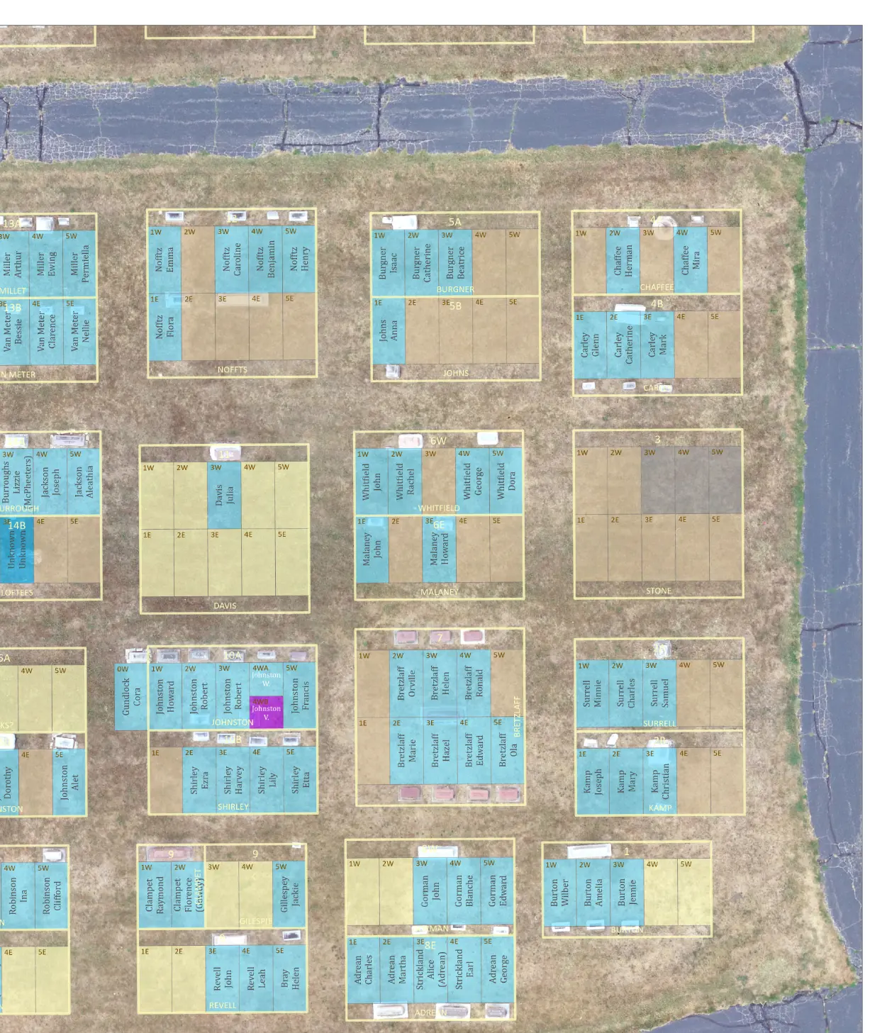
We specialize in cemetery map revitalization and interment record compilation where maps and records don't exist.
Townships tend to inherit cemetery maintenance and subsume it into their daily workflows.
More often than not, the maps and records needed to maintain the grounds no longer exist, or are lost to time. We rebuild both from field evidence and archival review.
Everything you need to manage your field activities.
High-resolution, low-altitude photogrammetry and precision mapping. Sections, lots, and spaces placed where they're actually found, not where the conceptual design assumed they'd be.
Every interment cross-checked in the field. A boots-on-the-ground approach that validates and confirms existing interment records without assumptions.
A digitally compiled record drawn from field data and existing documentation, updated as your records change.
Delivered in formats your staff can use at the office and in the field. Need maps at various scales? We can author your next cemetery map book or produce a full wall mount to cover an office wall on a variety of media.
New burials, lot sales, and corrections handled on request.
Four steps. One reliable map.
Precisely georeferenced drone imagery, headstone photos, and professional annotation.
Cross-check inscriptions and field placement against existing records.
New and accurate maps and an indexed record of interment that accounts for every grave space.
Revisions on request as the need arises.
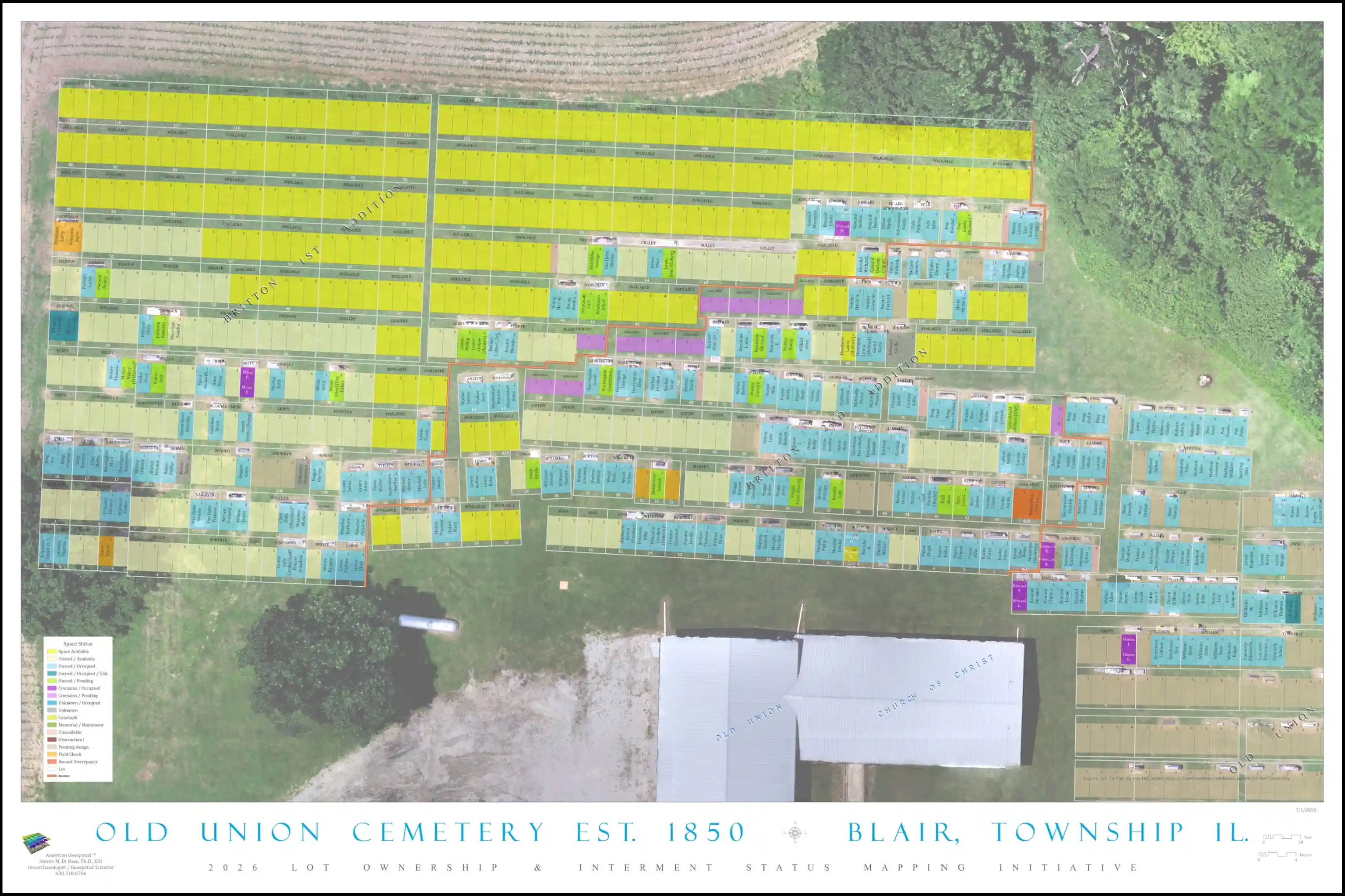
Britton Addition of Old Union Cemetery, Blair Township
The map below is just one deliverable from our field-verified work and thorough records review. Additional deliverables included a map of Lot Ownership and a set of books detailing ownership and interment status. The same cartographic standard and level of detail is provided for your grounds — regardless of whether you have existing maps or a record of interment.
Need a map that stays current?
We validate what you have today and provide updates as your cemetery grows.
Contact Us